Showing posts with label Scene. Show all posts

Thursday, January 14, 2016

Winter Scene Eddy Park On The Bulkley River Telkwa British Columbia (7 Pictures)


Above Photo: The frozen Bulkley River and Hudson Bay Mountain covered in cloud as 
seen from Eddy Park Telkwa, B.C.

Telkwa British Columbia is a small community with a population of approximately 1,350 people and is one of my favorite places to be. 

At Telkwa you have the Bulkley and Telkwa Rivers meeting in a very scenic location and has tourists stopping and taking pictures and enjoying the beauty. Also located at Telkwa is the beautiful Tyhee Provincial Park. This provincial park is a wonderful place to camp so you can explore the community of Telkwa.


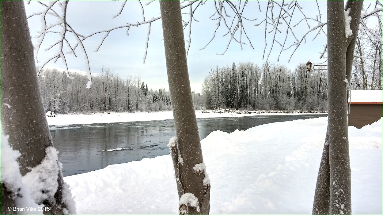
Above Photo: The ice filled Bulkley River looking towards the two bridges 
seen from Eddy Park Telkwa, B.C.

Tyhee Provincial Park. 


As I mentioned before, the Bulkley river is one of the best Steelhead fisheries in the world and anglers travel great distances to to fish the river making all their dreams come true.

Also from Eddy Park, and in the distance you can view the Hudson Bay Mountain in Smithers and the Telkwa mountain Range which will take your breath away. Put Telkwa, British Columbia on your bucket list, you won’t be disappointed.


Above Photo: The frozen Bulkley River and Hudson Bay Mountain covered in cloud as seen from inside the gazebo at Eddy Park Telkwa, B.C.

Below Text Source Information: From Wikipedia, the free encyclopedia.

Telkwa is a village located along British Columbia Highway 16, nearly 15 kilometres (9 miles) southeast of the town of Smithers and 350 kilometres (220 mi) west of the city of Prince George, in northwest British Columbia, Canada.


Above Photo: The frozen Bulkley River and Hudson Bay Mountain covered in cloud as seen from inside the gazebo at Eddy Park Telkwa, B.C.

Settlement in the area began around 1904 in a town site known as Aldermere on the hill above Telkwa. Around 1907, people began to move down the hill to be closer to water supplies and the anticipated route of the Grand Trunk Pacific Railway. 

The name Telkwa is possibly a native term for "meeting of the waters" which appropriately describes the confluence of the Bulkley and Telkwa Rivers in town.


Above Photo: The Bulkley River in Winter.

Via Rail's Jasper – Prince Rupert train calls at the Telkwa railway station several times per week.

The history of the town can be explored at the Telkwa Museum and on a tour of the historic former town site of Aldermere. 


Above Photo: The ice filled Bulkley River looking towards the two bridges 
seen from Eddy Park Telkwa, B.C.


Above Photo: Moving along Highway 16 east for my next adventure.

If you have a picture or story you would like to share on the Travel British Columbia with Brian Vike blog, please contact me at b_vike@telus.net

Travel British Columbia with Brian Vike.

Travel Houston, British Columbia with Brian Vike.

Friday, December 18, 2015

Winter Scene - The Equity Silver Mine Road Houston British Columbia (75 - Pictures/Slideshow)


Above Photo: At the top of the rock bluff the tree tops are pure white from the snow and frost and in summertime you can see the white haired mountain goats laying down sun baking all seen from the Equity Silver Mine Road Houston, British Columbia.

Once again we headed off on a new adventure, this time closer to home. On December 14, 2015 we decided, since it was a beautiful day to take a drive out on the old Equity Silver Mine Road. The road had been ploughed recently so it was like a super highway. The sky was deep blue and the snow crystals glistened in the sunlight.


Above Photo: As you can see by the tracks in the snow 
someone was already out and snowshoeing.

The Equity mine road has been one of my favorite places to visit which is just outside of town. Years back in the summer we would take all the little kids to a spot where they could catch some trout, and it was right at the side of the road. They would cast out their fishing line with a float attached and wait for the float to bob up and down. Of course there was always a juicy worm on the hook. 


Above Photo: One of the meadows on the mind road in Houston, British Columbia.

As they waited, which wasn’t long at all the bobber started it’s dance across the water with the end of the fishing rod bent over. The kids always had a lot of fun catching the fish and releasing them back into the pond. We had a blast just watching their expressions on their young faces.


Above Photo: The pond where the little ones would fish on.

Also in the summer the tall grass grows high in the miles of meadows. Moose, bear, wolves, foxes, deer and a host of smaller creatures could be seen wandering all throughout the area. The scenery along the mine road is amazing no matter what season we are in. 


Above Photo: One of the meadows on the mind road in Houston, British Columbia.

Seeing winter is here, the miles of meadows are a winter playground for all. Snowmobiles can be seen racing through the snow at top speeds, or slowing down to pull sleds across the snow with their family members yelling out with laughter. Cross country skiing is big there as well, or maybe you might like to strap on snow shoes and make a new trail across the landscape.


Above Photo: The miles of meadows to have fun on, and if you look way, way back in the photo, you will see the snow capped China Nose Mountain which was the scene for a large Wildfire on August 11, 2014. Below link to photos.

On Monday, August 11, 2014 a Wildfire was reported and the fire’s location was approximately 15km southeast of Houston, British Columbia. 

The China Nose wildfire consumed an estimated 3,450 hectares.

The cause of this fire was lightning. 

A fire camp has been set up approximately 6 km east of Houston, B.C. just off of highway 16.


Above Photo: China Nose Mountain Wildfire on August 11, 2014 just outside 
Houston, British Columbia.

Also just off the mine road we would find the most beautiful Christmas trees. So many of the trees looked like they were cultured trees that you would purchase at a retail store.  


Above Photo: One of the meadows on the mind road in Houston, British Columbia.

Whatever outdoor activity you are into, the Equity mine road has it all. 

We would love to see you here in Houston, B.C. so we can share this 
wonderful snowy paradise with you all.


Above Photo: One of the meadows on the mind road in Houston, British Columbia.

Sunday, December 13, 2015

Winter Scene - Travel To Beautiful Houston British Columbia (11 - Pictures)


Above Photo: The Bulkley River filmed from the Bulkley Valley bridge.

Well another dawn arrived in Houston, B.C. with yet another heavy snowfall on the ground. Everything, I mean everything is white. So on December 13, 2015 I headed out harmed with camera, water and pop to one of my favorite places around Houston.

Knockholt for me holds a lot of good memories, my kids when younger would swim in the Bulkley River at Knockholt. Then my daughters kids did the same. They could build sandcastles with moat, ride inner tubes down the river or just splash around having a good old time. 


Above Photo: CN Railway line crossing McKilligan Road.

The scenery there never lets you down, and the beauty about this location is that you can drive right to it. From Houston heading east the distance is only a 8.6km drive along Highway 16 and make a right hand turn onto McKilligan Road, a few hundred yards down the road and you can park your vehicle and within a few steps you are sitting by the river. 


Above Photo: Three of 15 Bald Headed Eagles sitting in the trees around the Bulkley River.

At this location there are two beaver dams on the river which has a lot of water backed up. Today there was a stack of Bald headed Eagles there, I don’t know why they were hanging out in this one area, maybe for fish or a beaver as there was a small open area in the ice.


Above Photo: A bit of open water on the Bulkley River. 

For folks who want to take a break from winter, there is the Houston leisure facility. This facility on a cold snowy day is just perfect to take the family to. There is the popular lazy river with hydro air jets, a 20-person swirl pool and steam room. There is a viewing area at poolside for the moms, dads and grandparents so they can see how their little ones improved on their swimming moves, plus there are lifeguards always on duty. The leisure facility also has a 1,600 square foot gym with weight training equipment and free weights and cardio machines available.


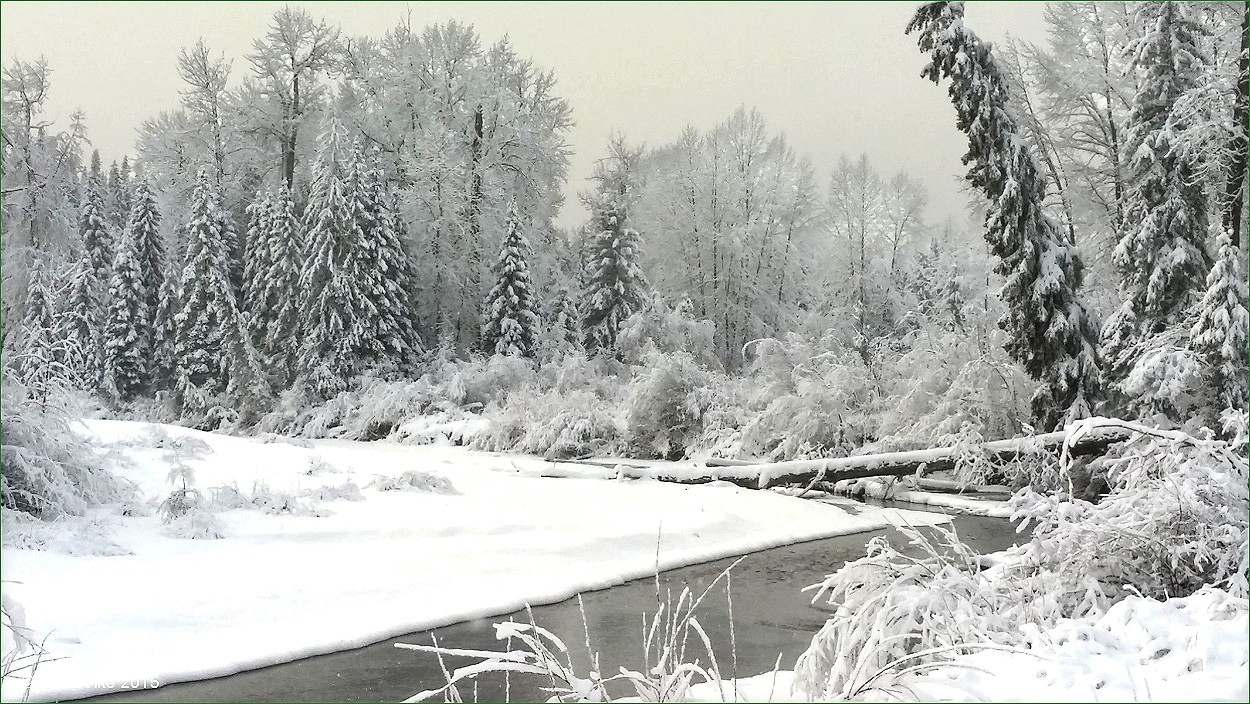
 Above Photo: A blanket of snow covers everything at the Bulkley River.

Houston Leisure Facility:


Above Photo: A blanket of snow covers everything at the Bulkley River.

If you don’t want to get wet, then there is the Houston Public Library where you can grab a good book, curl up on one of the comfy couches, or surf the internet free for something interesting to build or look at. There are magazines and newspapers available, and you can even pick out a free DVD movie to take home. Of course the library has so much more to offer, so the next time you have some free time on your hands, check out the Houston Public Library. 

Houston Public Library website:


Above Photo: A blanket of snow covers everything at the Bulkley River.

With winter at our doorstep, people still like to play in the cold, even if it is indoors, there is the Houston and District Curling Club for men and women of all ages. Also if you are planning some type of event, you can rent the upstairs.

For more information and direction to the Curling Club, please visit the following link:


Above Photo: A blanket of snow covers everything at the Bulkley River.

If you are into strapping on a pair of ice skates, you can go skating at the Claude Parish Memorial Arena, or take in one of the hockey games. There are lots of things to do in Houston, which I have talked about in previous postings, so all you need is to use a little imagination and your off.


Above Photo: A heavy blanket of snow covering everything.

Houston and District Chamber Of Commerce/Visitors Centre website:


Above Photo: A heavy blanket of snow covering everything.


Above Photo: A heavy blanket of snow covering everything.


Travel British Columbia with Brian Vike.

Travel Houston, British Columbia with Brian Vike.

Friday, December 11, 2015

Winter Scene - CN Railway Bridge Telkwa British Columbia (4 - Pictures/Video)


Above Photo: CN Railway bridge over the Telkwa River, the Telkwa River 
flows into the Bulkley River.

Telkwa is a wonderful small village which can be found in British Columbia. If you are planning a trip through, or to visit you would follow Highway 16 west from Prince George, B.C. for approximately 350 kilometres. Telkwa and area are rich in history and you can venture through Telkwa’s Museum for a look back in time. Also Telkwa boasts about it’s Tyhee Lake Provincial Park, and they have a right too, it is beautiful. 


Above Photo: CN Railway bridge over the Telkwa River, the Telkwa River 
flows into the Bulkley River.

Camping is available in the park and the campsites are secluded, this way you can lay back and take it easy and there is large parking lot for day visitors. Also on site are horseshoe pits and a volleyball net in case you want to get your competitive side on.

If you want to get onto the water, there is a boat launch, so you can go water skiing, canoeing, kayaking and paddle boarding are just some of the things people enjoy. You can go swimming, but there are no lifeguards on duty, so do swim in designated areas for safety. If you want to try your luck at catching a fish, there are stocked rainbow trout and native cutthroat trout for the catching. Folks also enjoy a bicycle ride or a hike around the area on the many trails.


Above Photo: Road bridge over the Bulkley River at Telkwa, British Columbia.

There is wildlife in the area, so use caution, but keep your cameras handy as you might see a bear, moose, deer or some other types of small critters. 

Now that winter is setting in, we certainly won’t be camping, but Telkwa offers travelers snowshoeing and cross-country skiing. You can also ice skate on the lakes, but always check to make sure the ice is thick enough to hold your body weight. Ice fishing is also available and can have some awesome results. Telkwa’s next door neighbour Smithers, has a great ski hill called Hudson Bay Mountain. People travel from around the world to ski in it’s powder. 


Above Photo: Ice flows on the Bulkley River at Telkwa, British Columbia.

So no matter the time of the year, Telkwa is everyone’s playground. 

I shot a short bit of video showing the bridges and ice flowing down the river:

Winter Scene - CN Railway Bridge Telkwa British Columbia Video Clip:

For more information about Telkwa and surrounding areas, please visit: 

Telkwa’s website:

Smithers, B.C. Visitors Centre.


Travel British Columbia with Brian Vike.

Travel Houston, British Columbia with Brian Vike.

Winter Scene - Mountains And Dark Clouds Over Smithers British Columbia (3 – Pictures)


Above Photo: Glacier and Mountains in Smithers, British Columbia.

My wife and I were in Smithers, British Columbia on December 10, 2015 as I had to pick up some new glasses. 

One of the first things I wanted to do was too take some pictures of the 1,012 pound "Phantom Grizzly Bear" which was shot on Hungry Hill by Conservation Officers and is on display at the Smithers Airport Smithers, British Columbia. If you missed that post, here is the link 

1,012 pound "Phantom Grizzly Bear".

So we drove to the airport, I parked the car and ran inside of the airport and took a few pictures. I ran back out, jumped in the car and as we were leaving the airport’s parking lot, I noticed how nice the mountains looked with dark clouds hanging over them. 


Above Photo: Glacier and Mountains in Smithers, British Columbia.

I decided to pull the car over, I got out and took a few shots of the mountains.

I hope you enjoy them as much as I did.

If you need information about Smithers and area, also the Hudson Bay mountain ski hill, please visit the Smithers, B.C. Visitors Centre website. http://www.tourismsmithers.com/


Above Photo: Glacier and Mountains in Smithers, British Columbia.

Travel British Columbia with Brian Vike blog, please contact me at b_vike@telus.net


Travel Houston, British Columbia with Brian Vike.

Sunday, August 2, 2015

Winter Scene Frozen Pond Houston British Columbia (Photo)


This winter scene photo was taken from the Equity Silver mine road. In the summer months we would take the little ones up and they would hook into some trout, but always a catch and release. 

This would again be from Houston, B.C.

Photo Below: A creek ran into a pond filling it up with water. 
At times the fishing was great for the kids.

If you have a picture or story you would like to share on this page from around Houston, please contact me at b_vike@telus.net

Travel British Columbia with Brian Vike.

Thursday, July 30, 2015

Log School House Now Unintended Winter Scene Houston British Columbia (Photo)


Information Source, The District of Houston, B.C.  - A link about schools and photos can be found by visiting the website at: http://houston.ca/siteengine/activepage.asp?PageID=28

The Log Schoolhouse

The first little log school was built as a community effort in Houston in 1916. Harry Davis, an early resident and school trustee of this area, donated several acres of land for a school, located approximately where the community hall is situated in 1998. 

George Dungate and Andrew Martinson were among those who cut logs and dovetailed them by hand and put up the building. 

The school housed a wood heater, teacher's desk, several rows of students’ desks, a large book cupboard, and a coat rack.


If you have a picture you would like to share on this page from around Houston, please contact me at b_vike@telus.net

Saturday, July 25, 2015

A Beautiful Scene From Cariboo Country British Columbia (Picture)


For the below photo, I had taken the Greyhound bus down to see my Dad in Langley, B.C. from my home town of Houston. After my visit I headed back home on the bus and along the way I spotted this amazing scene and snapped the photo from the moving bus. 

This is one of my favorites from the trip.

Source information from Wikipedia, the free encyclopedia. https://en.wikipedia.org/wiki/Cariboo

The Cariboo is an intermontane region of British Columbia along a plateau stretching from the Fraser Canyon to the Cariboo Mountains. The name is a reference to the caribou that were once abundant in the region. 

The Cariboo was the first region of the Interior north of the lower Fraser and its canyon to be settled by non-indigenous people, and played an important part in the early history of the colony and province. 

The boundaries of the Cariboo proper in its historical sense are debatable, but its original meaning was the region north of the forks of the Quesnel River and the low mountainous basins between the mouth of that river on the Fraser at the city of Quesnel and the northward end of the Cariboo Mountains - an area that is mostly in the Quesnel Highland and focused on several now-famous gold-bearing creeks near the head of the Willow River, the richest of them all, Williams Creek, the location of Barkerville, which was the capital of the Cariboo Gold Rush and also of government officialdom for decades afterwards (it is now a museum town). 

This area, the Cariboo goldfields, is underpopulated today, but was once the most settled and most powerful of the regions of the province's Interior. 

As settlement spread southwards of this area, flanking the route of the Cariboo Road and spreading out through the rolling plateaus and benchlands of the Cariboo Plateau and lands adjoining it along the Fraser and Thompson, the meaning changed to include a wider area than the goldfields.

The grasslands of the Cariboo are home of the endangered American badger.


If you have a picture you would like to share on this page from around Houston, please contact me at b_vike@telus.net